Property Owners
Clear guidance when every moment matters.
Access property-specific information to support safe evacuation, identify relevant utility shutoffs and share essential details with emergency services.
A next-generation emergency intelligence ecosystem combining AI, infrastructure awareness, insurance intelligence, and operational coordination.
During a property emergency, firefighters, police and medical teams may need to act with incomplete information about the building’s layout, access points and hazards. Property owners face immediate uncertainty, while insurers need reliable evidence to assess the damage.
SmartRescue aims to close these information gaps through shared building intelligence.
Property Owners may lack clear guidance on how to respond safely in the first moments of an emergency, yet timely, informed action can limit how far a hazard spreads and how much damage it causes.
Emergency service teams often respond without immediate access to critical building information: layouts, access routes, potential hazards and the location of people needing assistance.
Insurers may receive fragmented post-incident information, limiting their ability to reconstruct the sequence of events, response actions and resulting damage.
163,000
people die from fire, heat and hot substances worldwide each year, and about 85% of fire deaths happen in residential buildings.
30 seconds
can be all it takes for a small flame to become a major fire.
Over 40%
of home fires in the US start with cooking, making it the leading cause.
$83,991
was the average US homeowners insurance claim for fire and lightning damage, about 5.4 times the $15,570 average property damage claim.
The information exists. It is just never in the right place at the right time.
Concept stage
SmartRescue gives every enrolled property a Safety Floor Plan: a floor plan marked with the places that matter in an emergency.

Hazard Points (red) — gas valves, electrical panels and other danger or control points.
Access Points (green) — doors, windows, fire escapes and roof access.
One shared operational picture.
The right intelligence for every role.
When an emergency is reported, SmartRescue connects property owners, dispatchers and emergency responders through shared building intelligence — providing occupants with safety guidance, supporting dispatch coordination, and giving field teams actionable insights. A documented incident record subsequently supports insurance assessment and claims review.
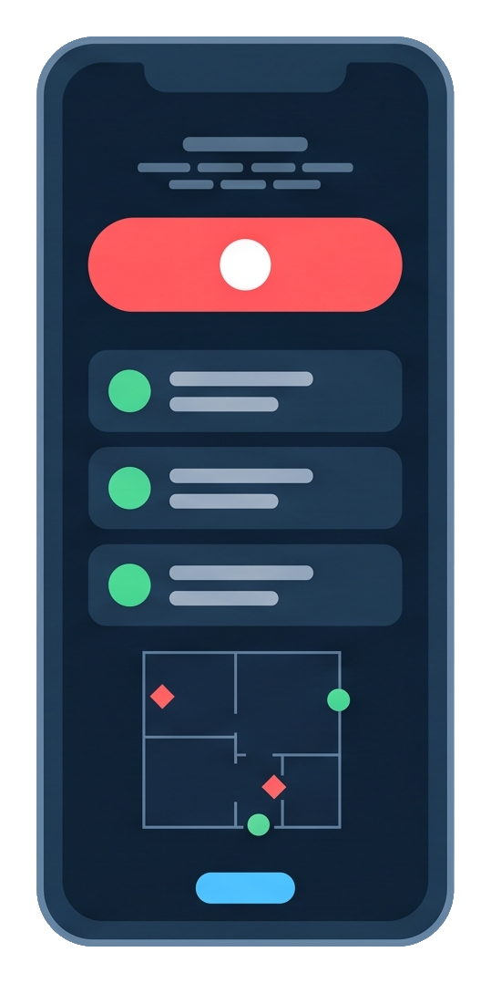
Owner
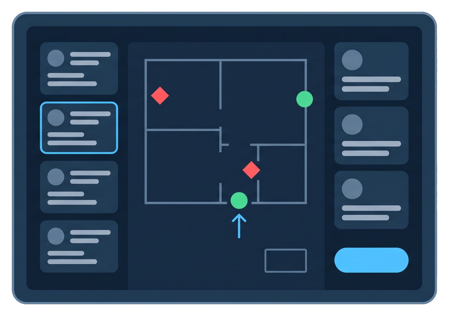
Dispatcher
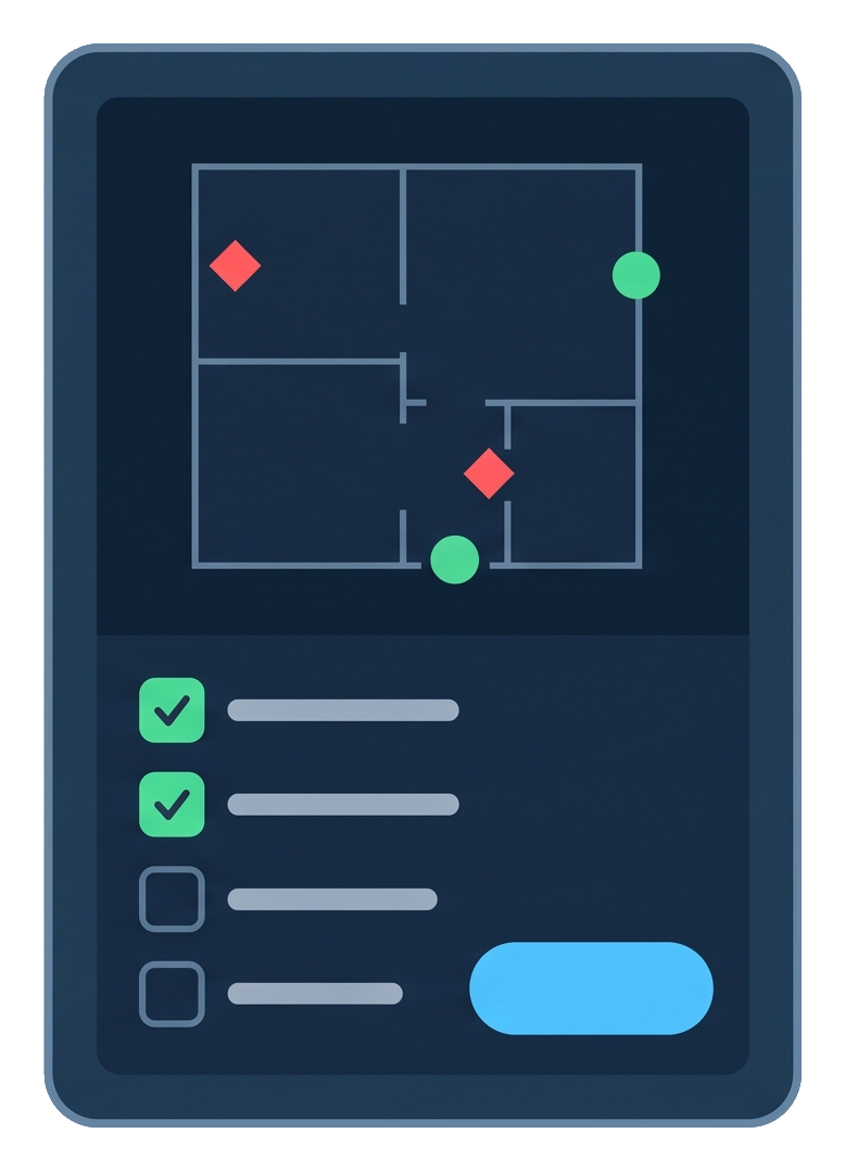
Field responder
Over time, the plan can grow into a 3D model of the building, built with AI from the plans or sketches the owner already has, so that responders can see the building before they arrive.
Concept stage
The property is registered with a digital Safety Floor Plan identifying its layout, access points, utility shutoffs and known hazards. Where suitable plans are unavailable, qualified professionals can prepare them.
An owner or occupant reports an emergency and receives property-specific safety guidance, including evacuation information and relevant precautions, subject to conditions and emergency-service instructions.
The incident details and Safety Floor Plan are shared with the emergency dispatcher, supporting coordination with responding teams on access, vehicle staging and operational priorities.
Responders arrive with essential building and incident intelligence accessible on their connected devices, supporting professional judgment, coordinated action and operational safety.
Captured incident data and recorded response activities are consolidated into a structured, timestamped report, supporting post-incident review, insurance assessment and claims verification.
Demo
Explore how SmartRescue is designed to connect property owners, emergency dispatchers, frontline responders and insurers through shared building intelligence — from the initial alert and coordinated response to damage assessment and insurance reporting.
Who it's for
Concept stage
Clear guidance when every moment matters.
Access property-specific information to support safe evacuation, identify relevant utility shutoffs and share essential details with emergency services.
Building intelligence for informed coordination.
Access building layouts, identified hazards and available entry points as an incident is reported—supporting resource allocation, responder briefings and operational coordination.
Essential intelligence. Ready on arrival.
Access building layouts, identified hazards and critical locations on compatible devices—supporting situational awareness and informed decisions across fire, police and emergency medical operations.
A traceable incident record. A clearer basis for claims decisions.
SmartRescue automatically consolidates recorded response activity into a timestamped incident history, documenting actions, personnel and timing to support faster, better-informed claims assessment—with a unified view across your insured property portfolio.
Market
SmartRescue sits where three growing markets meet: property insurance, indoor mapping and AI for public safety. Insurers want better risk data. Emergency services want better information on arrival. Technology to capture and use building data is getting cheaper.
Why now
Advances in AI, mobile scanning and 3D mapping are creating new opportunities to transform building information into actionable intelligence.
SmartRescue aims to bring these capabilities together—enabling property owners to contribute digital plans and critical building data to support emergency response, risk assessment and insurance claims.
Why SmartRescue
Insurers and security providers encourage property owners to contribute building plans and critical safety information, potentially supported by premium or service incentives.
Broader building coverage gives emergency responders more actionable intelligence, supporting safer interventions and helping limit damage and insured losses.
Demonstrated benefits strengthen the platform’s value for owners, responders and insurers—encouraging wider participation and continued expansion.
The road ahead
Beyond its initial phase, SmartRescue envisions integration with a range of field robots, extending its building intelligence to remote inspection and insurance damage assessment in challenging environments.
Collect images, spatial measurements and sensor readings.
Locate damage on the 3D plan and compare with available pre-loss records.
Prepare an illustrated draft with findings, evidence and items requiring verification.
A long-term direction, not part of the first version.